December 2023
Liton Chakraborty
Kasra Motlaghzadeh
Mohammad Sina Jahangir
Jason Thistlethwaite
Daniel Henstra
Andrews, Sheldon
Bora Pulatsu
Daniele Malomo
Jennifer A. Spinney
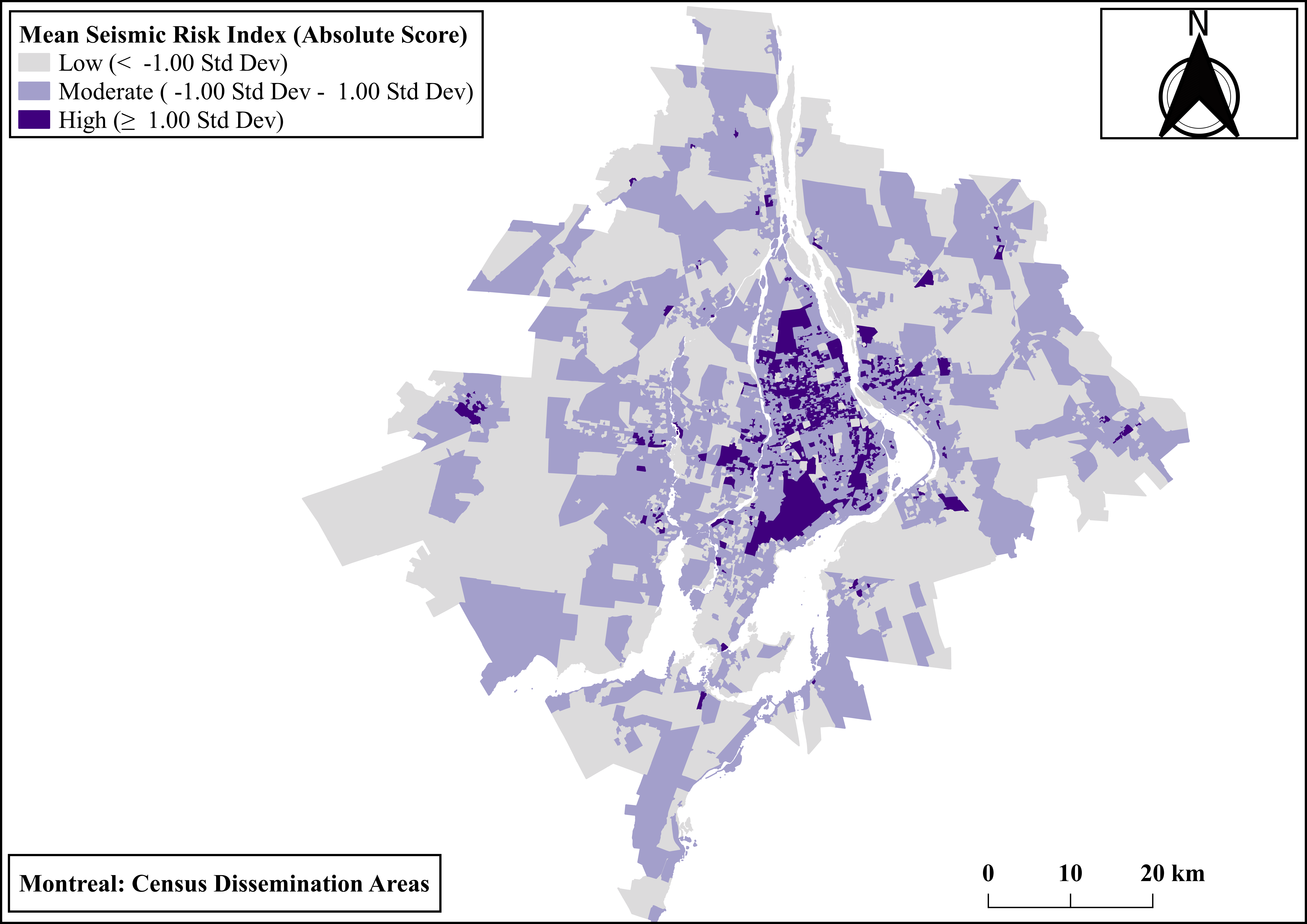
This project examines the intricate relationship between socioeconomic deprivation and the probabilistic seismic risk in two prominent census metropolitan areas, including Ottawa-Gatineau and Montreal. The geospatial and statistical analysis allows a nuanced understanding of how socioeconomic factors influence a community’s vulnerability to seismic risk. The research utilizes spatial integration and in-depth statistical exploration to pinpoint areas of particular concern. These methods help identify risk hotspots – regions with high seismic risk scores that are surrounded by high socioeconomic deprivation index scores. These hotspots represent areas where communities face a double burden of vulnerability, making them a focal point for targeted intervention and disaster preparedness efforts. Recognizing the importance of effectively communicating research findings, the project employs ArcGIS-based interactive web maps as a visual medium to present the results. These interactive maps offer a user-friendly way for policymakers, emergency planners, and the public to understand the complex relationship between socioeconomic factors and seismic risk in the study area.