March 2021
Liton Chakraborty
Jason Thistlethwaite
Daniel Henstra
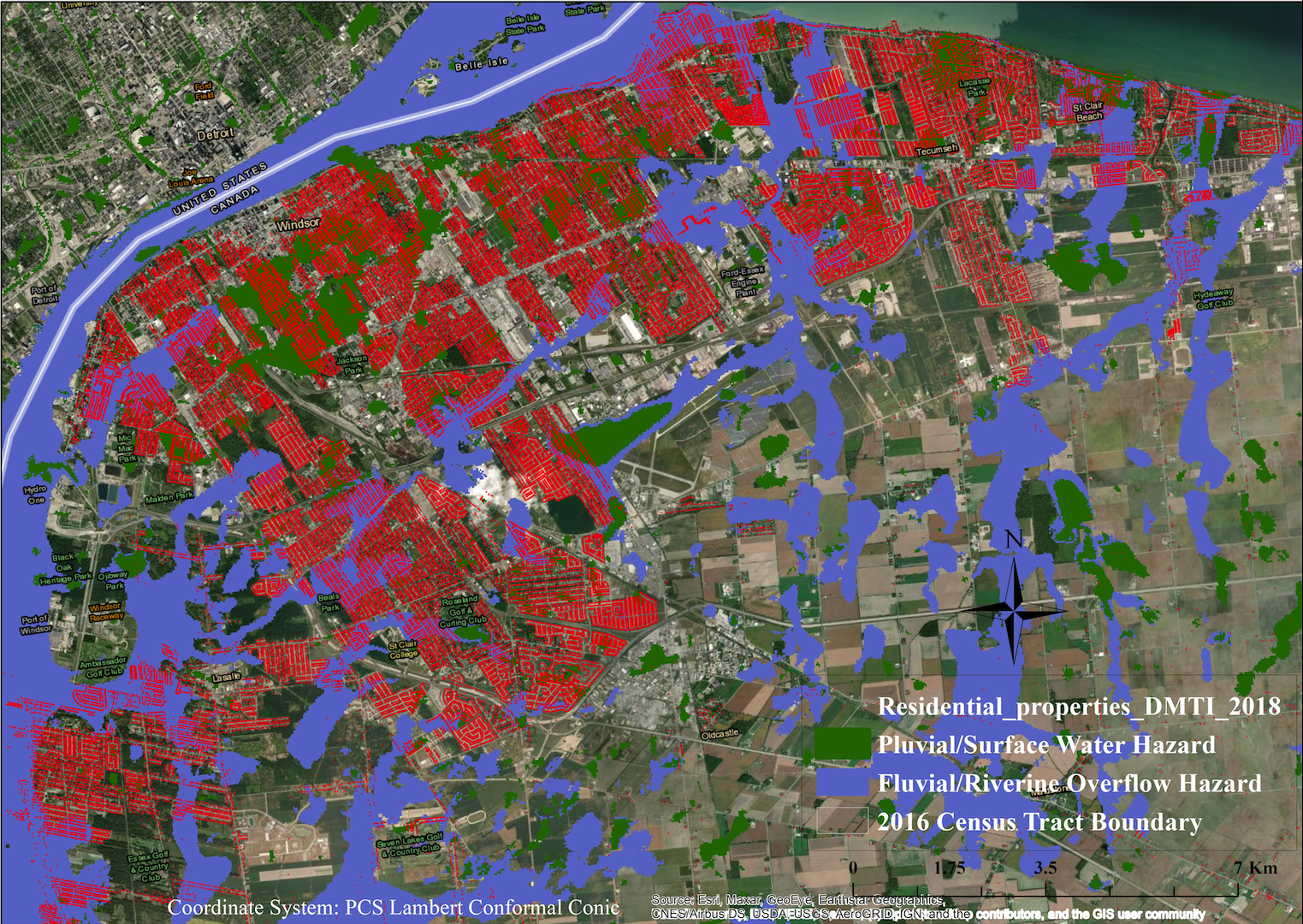
In a warming climate, Canadian cities are at risk of increasingly severe and frequent floods. Nearly 80 percent of Canadian cities are built on floodplains, exposing populations, property, and infrastructure to flood risk. Methods for measuring socioeconomic vulnerability to flood risk in Canada are in their infancy. This case study seeks to validate methods, identify data gaps, and draw out potential implications for public policy. Windsor, Ontario was identified as a suitable focus due to its considerable exposure to flood risk. The results reveal hotspots of flood risk across neighbourhoods that have both a high concentration of socially vulnerable groups and a high exposure to flooding. We also consider potential policy interventions to address this geographically concentrated flood risk, with a focus on socioeconomic vulnerability.